
The Challenge
Wildfire response teams face the same structural problem conservation teams face in BioTrack AI, in a higher-stakes setting: critical information arrives from disconnected sources — satellite passes, patrol flights, ground sensors, weather feeds — each on its own schedule and format. A fire that doubles in size in twenty minutes doesn’t wait for those feeds to be manually reconciled into a single picture.
DronEye started this demonstrator to test whether the same multi-sensor fusion and AI pipeline built for BioTrack AI — detection, Earth Observation correlation, predictive analytics, a GIS dashboard — could be re-applied to a fundamentally time-critical problem rather than a periodic-survey one.
The Approach
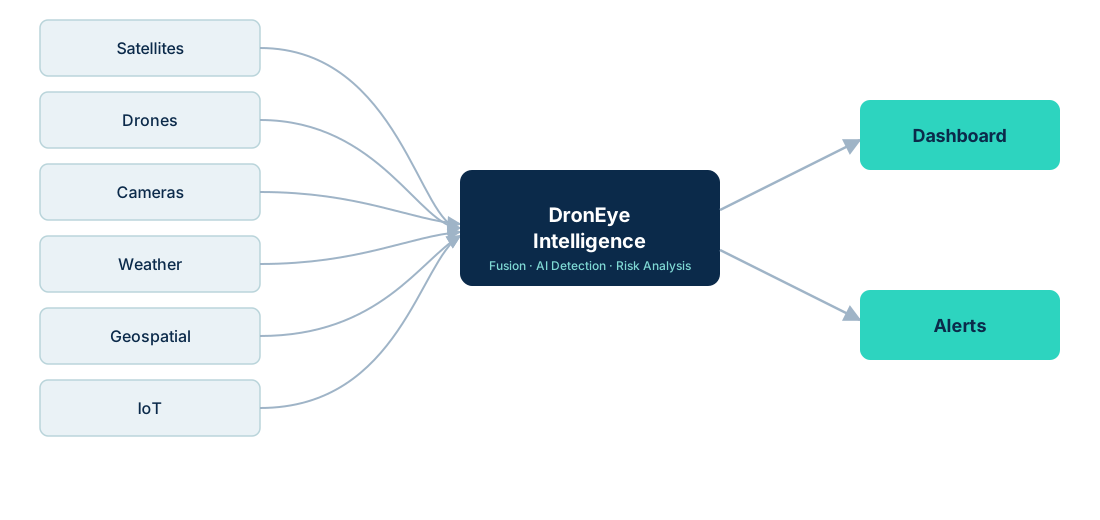
The demonstrator reuses DronEye’s existing intelligence-fusion architecture rather than building a new pipeline from scratch:
What’s being tested
Detection latency
How quickly a thermal anomaly from satellite data can be flagged and cross-checked against weather conditions.
Spread modeling
Whether terrain, fuel load and wind data can produce a usable short-horizon spread estimate, not just a static risk map.
Dashboard usability
Adapting the BioTrack AI GIS dashboard pattern to a fast-moving, alert-driven workflow instead of a periodic-review one.
Data gaps
Identifying which data sources are reliably available in practice versus which require a dedicated partner or sensor network.
Why This Matters Beyond Wildfire
Proving this architecture generalizes from a periodic-survey problem (wildlife) to a real-time, high-stakes problem (wildfire) is the real point of the demonstrator: it’s evidence that DronEye’s core stack — sensor fusion, Earth Observation integration, AI detection, GIS delivery — is a reusable platform, not a one-off build for a single customer.
Where We Are Now
Architecture validated
The BioTrack AI pipeline pattern has been adapted and run against historical wildfire datasets rather than live feeds.
Historical case replays
Past wildfire events are being replayed through the detection and spread-modeling pipeline to validate the approach before any live pilot.
Dataset build-out in progress
Assembling thermal, weather and terrain datasets for the regions under evaluation.
Looking for a pilot partner
The next step is a live pilot with a fire authority, forestry agency or insurer willing to validate the approach operationally.