
The Challenge
Wildfire response depends on information arriving from many disconnected sources — satellite passes, patrol flights, ground sensors, weather feeds — each on its own schedule and in its own format. By the time it’s assembled into a single picture, conditions have often changed. Early detection and accurate spread prediction both depend on closing that lag.
Our Approach
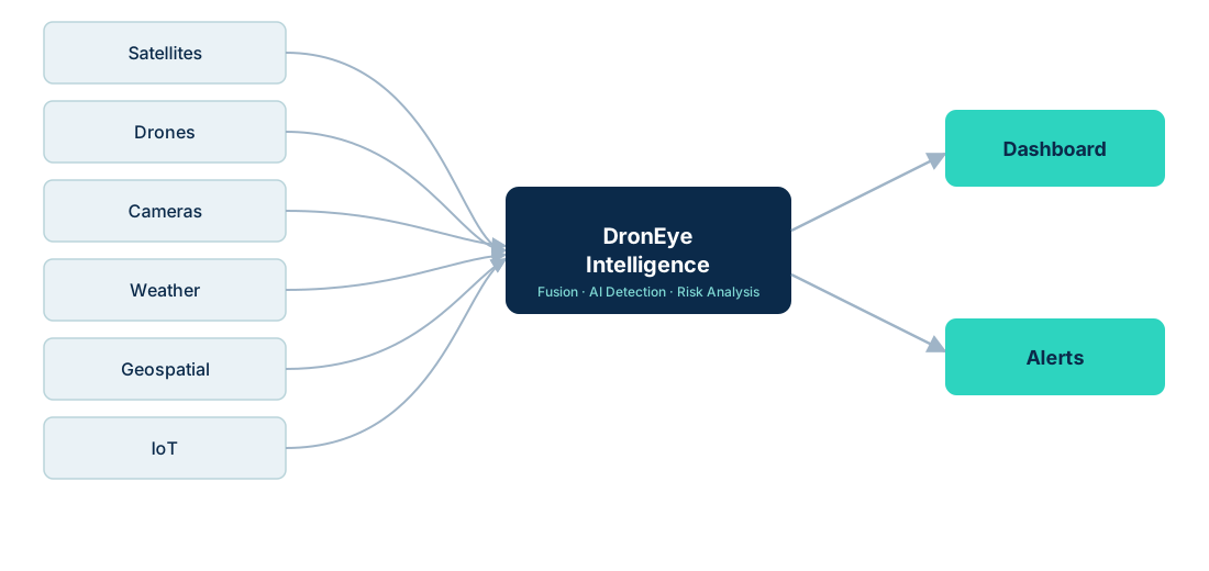
We combine the following data sources through AI detection, risk analysis and spread-prediction models, visualized on a single GIS dashboard:
Outcomes
Early detection
Flag ignition events before they're visible to routine patrols.
Situational awareness
One live view instead of five disconnected feeds.
Fire perimeter analysis
Track how the fire boundary is changing over time.
Risk assessment
Combine terrain, fuel load and weather into a risk score.
Spread prediction
Model likely direction and rate of spread.
Resource planning
Prioritize where crews and equipment are deployed.